August 2026 Satellite Image Challenge
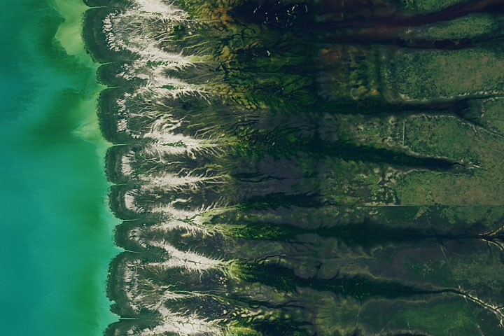
The National Geospatial-Intelligence Agency (NGA) has issued a challenge to the public, asking them to identify the location of a satellite image and explain its significance. The image was captured in August 2026. This annual "Satellite Puzzler" aims to test and engage the public's geospatial intelligence skills. Participants are encouraged to submit their findings and reasoning. The NGA uses these challenges to foster interest in geospatial intelligence and to potentially identify emerging talent within the field. Further details about the specific image and submission guidelines are expected to be released.
This challenge by the NGA leverages public engagement to crowdsource geospatial intelligence, a practice that can augment traditional analysis capabilities. By posing a "puzzler," the agency taps into diverse perspectives and potentially uncovers novel interpretations of satellite imagery. This approach can be particularly effective in identifying subtle anomalies or understanding complex ground truth that might be overlooked by a limited internal team. The long-term implications involve fostering a broader understanding of geospatial intelligence and potentially building a pipeline for future recruitment, aligning with the increasing demand for data analysis skills in the digital age.
AI-generated to prompt reflection — not editorial opinion, not advice, not a statement of fact. How this works.