Chenab River Faces High Flood Risk Amidst Heavy Rains in Kashmir and Punjab
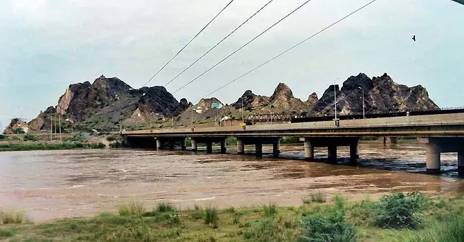
The Chenab River is anticipated to experience a significant surge in water levels, potentially entering a high-flood category within the next few days. This forecast is driven by ongoing heavy rainfall in the catchment areas of Indian-occupied Kashmir and recent downpours across parts of Punjab. Officials from the Punjab Irrigation Department have indicated that the situation could become critical if the predicted heavy rains materialize in these regions. The Pakistan Meteorological Department's Flood Forecasting Division (FFD) has issued a high-flood warning for major rivers, including the Chenab, and associated nullahs, with heavy rains expected until July 24. This increased flow is attributed to a combination of a westerly wave and a strong monsoon surge from both the Arabian Sea and the Bay of Bengal affecting river catchments. High flood levels are specifically forecast for the Chenab at Marala, the Jhelum upstream of Mangla, and various tributaries of the Jhelum, Chenab, and Ravi rivers. Additionally, flash flooding is predicted for hill torrents in DG Khan, streams in Khyber Pakhtunkhwa and northern Balochistan, and urban flooding in numerous cities across Punjab. In contrast, the River Indus is currently experiencing low to below-low water levels at multiple gauging stations, including Tarbela and Sukkur. Current reports show the Jhelum at medium flood and the Chenab at medium to high flood, while the Ravi and Sutlej rivers are flowing below low flood levels.
The current weather patterns highlight the vulnerability of Pakistan's riverine systems to extreme precipitation events, particularly in regions affected by monsoon systems and westerly waves. The potential for high floods in the Chenab and other rivers underscores the critical need for robust flood management infrastructure and early warning systems. As climate change intensifies, such events may become more frequent and severe, necessitating adaptive strategies in water resource management and urban planning to mitigate risks to infrastructure and populations. The disparity in water levels between the Indus and other rivers also points to complex hydrological dynamics that require continuous monitoring and integrated basin management approaches.
AI-generated to prompt reflection — not editorial opinion, not advice, not a statement of fact. How this works.