Cold Air Mass Brings Sharp Temperature Drop to Espírito Santo, with Forecasts as Low as 7°C
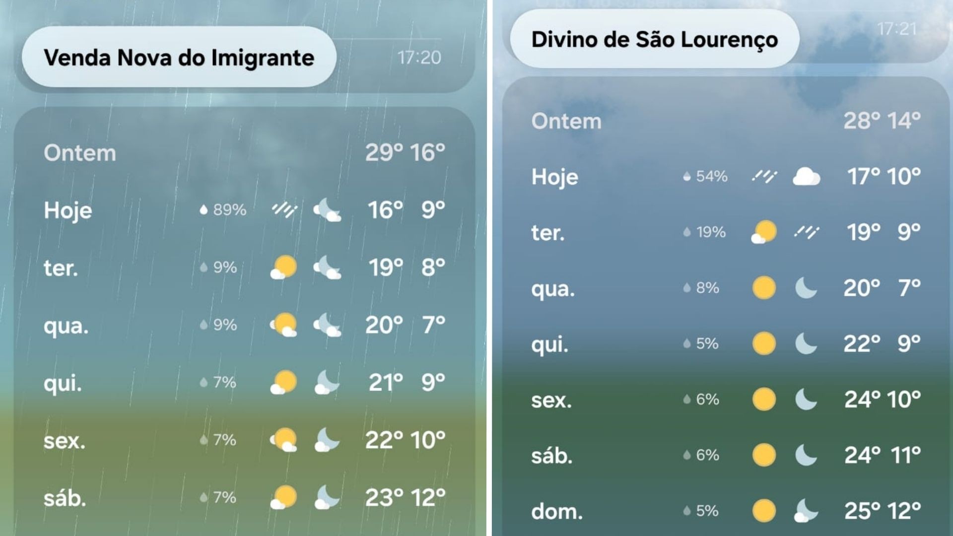
A significant cold air mass has arrived in Espírito Santo, Brazil, causing temperatures to plummet after a period of intense heat. The cold front, which advanced along the Southeast coast on Monday, February 13th, is expected to bring cloudy skies, rain, and strong winds to coastal cities. Following the front, a dry cold air mass will stabilize the weather, reduce cloud cover, and maintain lower temperatures, particularly during mornings.
Temperatures are predicted to remain low throughout the state. In Venda Nova do Imigrante, lows of 9°C are expected on Tuesday, February 14th, and 8°C on Wednesday, February 15th. Santa Teresa may see minimums of 10°C and 9°C on the same days, while Domingos Martins could register 9°C on Wednesday. Divino de São Lourenço, in the southern region, is forecast to experience a minimum temperature of 7°C on Wednesday.
The National Institute of Meteorology (Inmet) issued a yellow alert for coastal winds affecting 23 municipalities in Espírito Santo, valid until the end of Monday. This alert, classified as "potential danger," includes all 14 coastal cities and nine inland towns. Coastal areas may experience intensified winds, potentially causing sand dune movement towards beachfront constructions. Residents are advised to contact Civil Defense at 199 in emergencies.
The arrival of a cold air mass in Espírito Santo, as reported, highlights the dynamic interplay between atmospheric conditions and regional climate patterns. While the immediate impact is a significant temperature drop and associated weather phenomena like wind and rain, the broader implication relates to seasonal weather forecasting accuracy and public preparedness strategies. The issuance of a yellow alert by Inmet underscores the importance of robust meteorological monitoring systems and effective communication channels to mitigate potential risks from severe weather events. Looking ahead, understanding the frequency and intensity of such cold air intrusions is crucial for agricultural planning, infrastructure resilience, and energy demand management in the region, especially as climate models suggest potential shifts in weather variability.
AI-generated to prompt reflection — not editorial opinion, not advice, not a statement of fact. How this works.