Guatemala: Six Landslides Reported After Powerful 7.4 Magnitude Earthquake
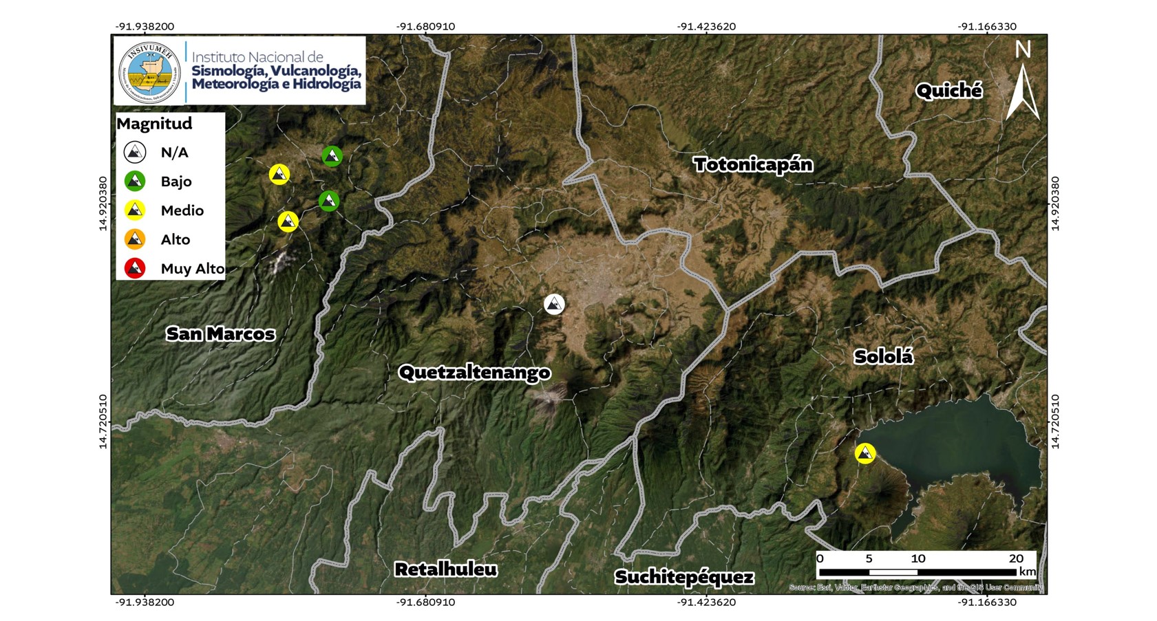
Following a significant 7.4 magnitude earthquake that struck Guatemala, the National Institute of Seismology, Vulcanology, Meteorology, and Hydrology (Insivumeh) has confirmed the occurrence of six landslides. The seismic event triggered these geological responses across several departments. Specifically, four landslides were reported in the department of San Marcos. Additionally, one landslide occurred in Quetzaltenango, and another was recorded in Sololá. These events highlight the immediate geological impact of strong seismic activity on the region's terrain. Insivumeh continues to monitor seismic activity and its potential consequences.
The earthquake's magnitude and subsequent landslides underscore the seismic vulnerability of Guatemala's terrain. This event serves as a critical reminder of the need for robust geological monitoring and early warning systems, especially in regions prone to seismic activity. Future infrastructure development and land-use planning must integrate comprehensive risk assessments to mitigate the impact of such natural disasters. The response capacity of local authorities and the effectiveness of disaster preparedness protocols will be key factors in managing the aftermath and preventing future losses.
AI-generated to prompt reflection — not editorial opinion, not advice, not a statement of fact. How this works.