Guinea-Bissau's Bijagós Archipelago: A Tidal Landscape
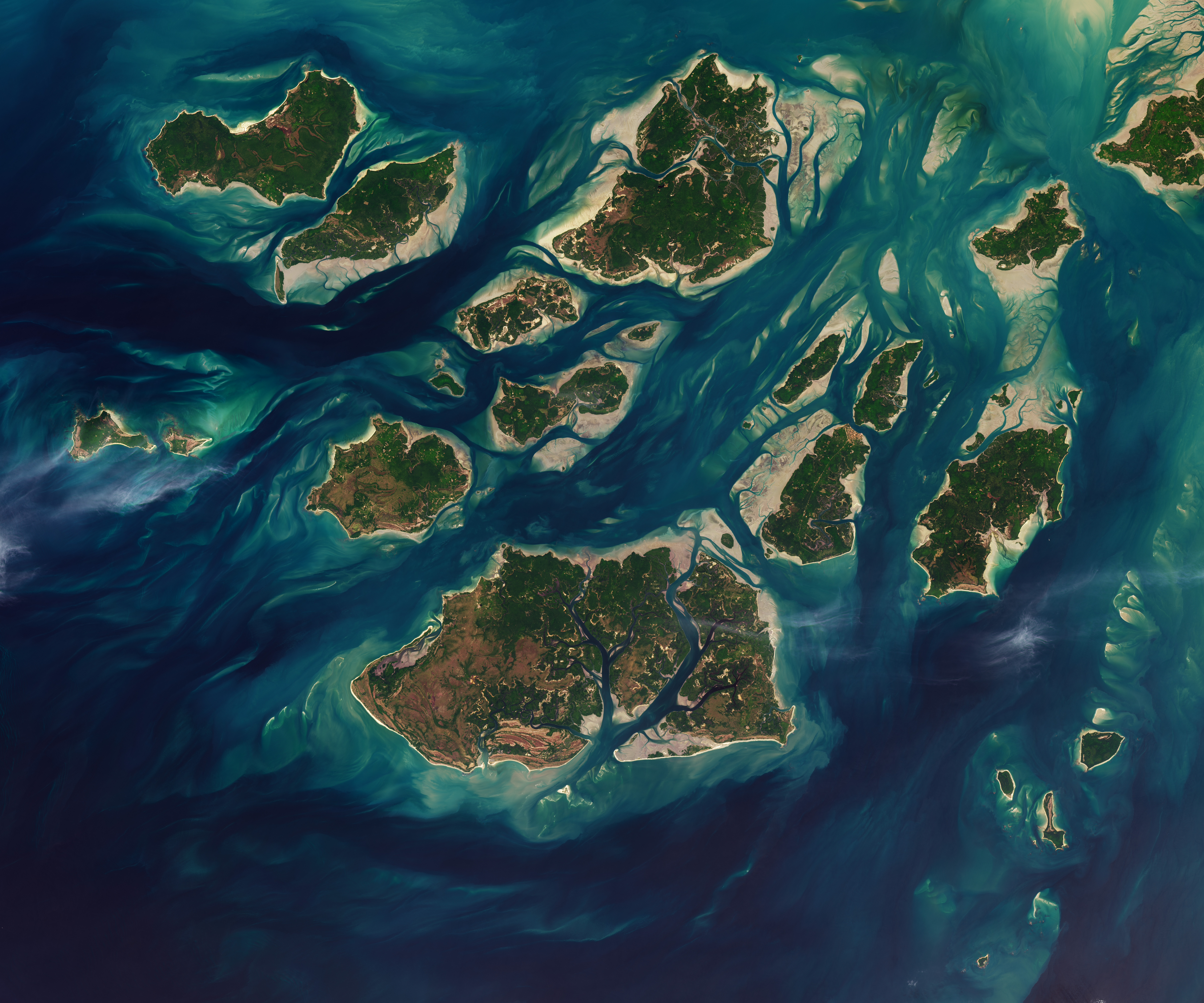
The Bijagós Archipelago, located off the coast of Guinea-Bissau, features a dynamic landscape shaped by tidal forces. Twice daily, tides move through a complex network of sandy channels, mudflats, and mangrove forests that surround its 88 islands and islets. This ebb and flow significantly alters the visible terrain, revealing extensive intertidal mudflats and sandflats during low tide. The provided image, captured on November 28, 2025, offers a bird's-eye view of this constantly changing environment. The archipelago's unique geography is a result of these powerful natural processes, creating a distinct ecosystem characterized by its intertidal zones.
The visual representation of the Bijagós Archipelago highlights the profound impact of natural hydrological cycles on coastal geography. This dynamic intertidal zone, subject to daily tidal fluctuations, presents a unique environmental system. Understanding the resilience and adaptability of such ecosystems is crucial in the context of rising sea levels and potential climate change impacts on coastal regions globally. Future infrastructure development or conservation efforts in such areas must carefully consider these powerful, recurring environmental shifts to ensure long-term sustainability and minimize ecological disruption.
AI-generated to prompt reflection — not editorial opinion, not advice, not a statement of fact. How this works.