IncendiosEspaña.es: New Platform Maps Spanish Wildfires with Real-Time Satellite Data
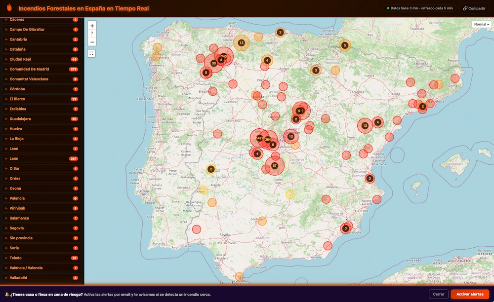
A new online platform, IncendiosEspaña.es, is consolidating official and satellite data to provide near real-time tracking of wildfires across Spain. The website integrates information from emergency services in various autonomous communities with heat data from NASA FIRMS, EUMETSAT, and Copernicus/EFFIS. This allows for frequent updates, typically every 5 to 15 minutes, offering a comprehensive view of the fire situation. During a recent check, the platform displayed 47 confirmed active fires and 2,288 satellite-detected hotspots across the Spanish mainland within the preceding 24 hours. The map visually represents fires, indicating their radiative power through size and color, confidence levels of detections, and burned areas. It also incorporates meteorological risk indices and additional data layers. These layers include information on wind, road closures, emergency beacons (V16), and alternative communication networks like LoRa, Meshtastic, and APRS, which are valuable when mobile coverage fails. The platform's maps are based on OpenStreetMap, allowing users to toggle various data layers on and off. The combination of global satellite data with localized information, such as the deployment of V16 beacons, offers a unique perspective on fire events and potential issues. By merging open data, official reports, and satellite observations from sources with varying resolutions and update frequencies, IncendiosEspaña.es provides a more complete picture than any single system alone.
The development of IncendiosEspaña.es highlights a growing trend of leveraging diverse data streams, from official emergency reports to global satellite observations, for enhanced situational awareness. This integration of public and private data sources, combined with advanced visualization techniques, empowers citizens and potentially improves response coordination. The platform's ability to consolidate information from multiple entities addresses the challenge of fragmented data in crisis management. Future iterations could explore predictive modeling based on historical data and real-time conditions, further optimizing resource allocation and public safety strategies. The inclusion of alternative communication networks also points to the critical need for resilient infrastructure during emergencies, especially in areas prone to mobile network disruptions.
AI-generated to prompt reflection — not editorial opinion, not advice, not a statement of fact. How this works.