India Braces for Heavy Rainfall as Satellite Images Show Widespread Cloud Cover
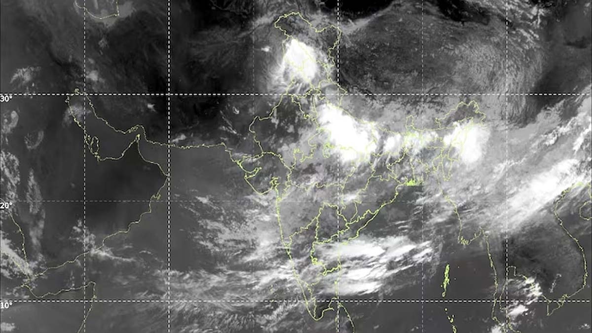
Satellite imagery from ISRO's INSAT-3DR on July 19th revealed dense cloud formations covering approximately two-thirds of India. The monsoon appears to be active, with cold, stormy clouds extending from Jammu and Kashmir across to the Northeast. This widespread cloud cover indicates a high probability of heavy rainfall across the country. The monsoon's current activity suggests a robust weather pattern is in place. The visual data from the satellite highlights the extent of the atmospheric conditions. Residents across various regions can expect significant precipitation in the coming days. The ISRO's monitoring capabilities provide crucial insights into impending weather events. This development is significant for agriculture and water resource management.
The extensive cloud cover observed across India signifies a potent monsoon season, presenting both opportunities for water replenishment and potential risks of flooding. The active monsoon system, as depicted by ISRO's satellite data, underscores the critical role of meteorological monitoring in disaster preparedness and agricultural planning. Understanding these atmospheric dynamics is essential for mitigating climate-related impacts and ensuring national resilience. The predictability of such weather events, aided by advanced satellite technology, allows for proactive measures to be taken by authorities and communities alike, fostering a more adaptive approach to seasonal challenges over the next decade.
AI-generated to prompt reflection — not editorial opinion, not advice, not a statement of fact. How this works.