Iran Releases Satellite Images of Alleged US Drone Control Center Damaged by Strikes
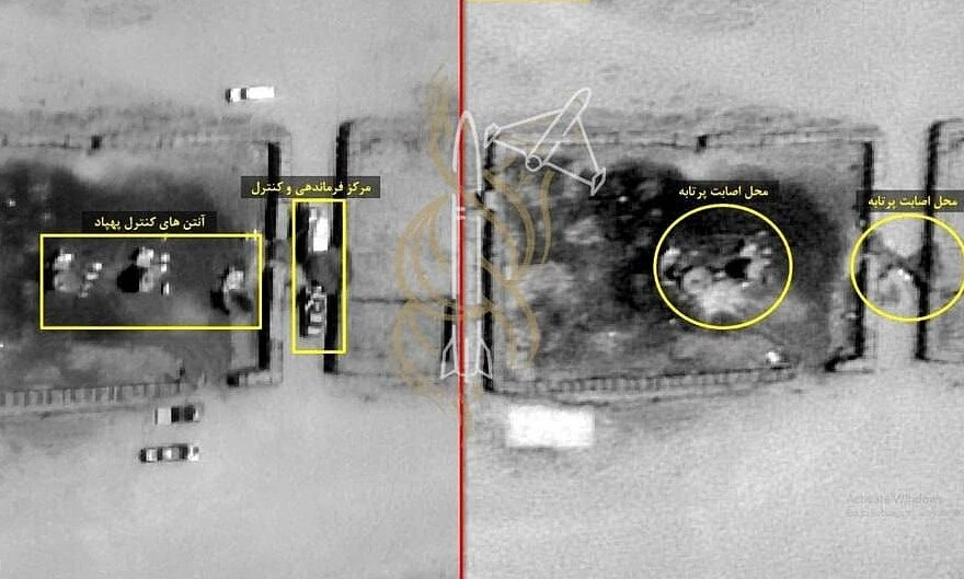
Iran has released satellite imagery purporting to show damage to a US drone control center in the Middle East. The images were published following retaliatory strikes. Iran claims these locations serve as key operational hubs for American unmanned aerial vehicles in the region. The release of the satellite photos is seen as a direct response to recent military actions. The specific site depicted in the imagery is identified as a critical node for US drone activities. This development highlights the escalating tensions and information warfare between Iran and the United States. The visual evidence, if corroborated, could support Iran's narrative regarding the impact of recent exchanges. The situation underscores the strategic importance of drone technology and control centers in modern military operations.
The release of satellite imagery by Iran, alleging damage to a US drone control center, represents a strategic information operation. By presenting visual evidence, Iran aims to demonstrate its retaliatory capabilities and potentially shape international perception of the conflict's impact. This action underscores the growing importance of open-source intelligence and counter-intelligence in geopolitical disputes. Future technological advancements in satellite imaging and drone warfare will likely intensify such information battles, requiring robust verification mechanisms and critical assessment of all presented data by global actors.
AI-generated to prompt reflection — not editorial opinion, not advice, not a statement of fact. How this works.