Millions of Americans Live in Landslide Hazard Zones, New Map Shows
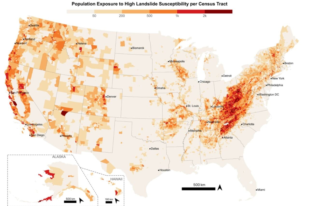
A new map has revealed that approximately 6.5 million Americans reside in areas prone to landslides. This information is crucial for understanding personal risk, especially as global temperatures continue to rise. Landslides are dangerous natural disasters, and awareness of their potential occurrence is becoming more critical. The map aims to provide individuals with the knowledge to assess their vulnerability to these events. The increasing frequency and intensity of extreme weather events due to climate change can exacerbate landslide risks. Therefore, knowing one's location within a hazard zone is a vital step in preparedness and safety planning. This initiative highlights the growing need for accessible data on natural disaster risks across the United States.
The release of this landslide hazard map underscores the growing intersection of climate change and public safety. As global temperatures rise, increased precipitation and altered weather patterns can destabilize geological formations, elevating landslide risks in previously considered safe areas. This data empowers individuals and communities to proactively assess and mitigate potential threats, shifting from reactive disaster response to proactive risk management. The map's utility will likely increase as climate models become more refined, providing a critical tool for urban planning, infrastructure development, and emergency preparedness in the coming decade.
AI-generated to prompt reflection — not editorial opinion, not advice, not a statement of fact. How this works.