NASA Satellites Track New Island Forming from Underwater Volcano Near Papua New Guinea
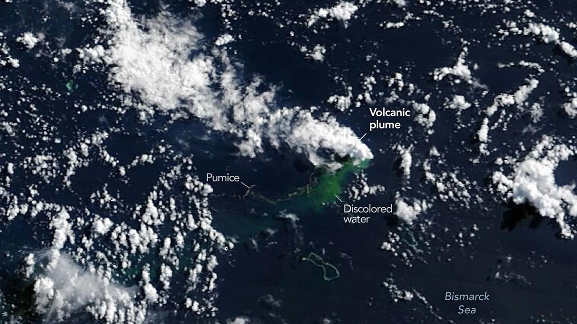
A significant underwater volcanic eruption is currently underway north of Papua New Guinea, an area known for its poorly mapped ocean basins. NASA satellites have been instrumental in observing this event, detecting prominent steam plumes, ash clouds, thermal hotspots, and extensive rafts of floating pumice. These observations strongly indicate that magma is ascending remarkably close to the ocean's surface. Scientists are closely monitoring the eruption to determine if it will result in the formation of a new island. This phenomenon presents a rare scientific opportunity to witness the geological process of new landmass creation in real-time.
The emergence of new land from volcanic activity in poorly charted regions highlights the dynamic geological processes shaping our planet. Satellite monitoring is crucial for understanding these events, providing data that can inform hazard assessments and scientific study. This occurrence offers a unique window into the early stages of island formation, allowing researchers to observe geological processes that are typically hidden beneath the ocean. Future research may focus on the long-term stability and ecological colonization of such nascent landforms, contributing to our understanding of island biogeography and geological evolution in the Anthropocene.
AI-generated to prompt reflection — not editorial opinion, not advice, not a statement of fact. How this works.