NASA Unveils Unprecedented Geoid Image of Earth
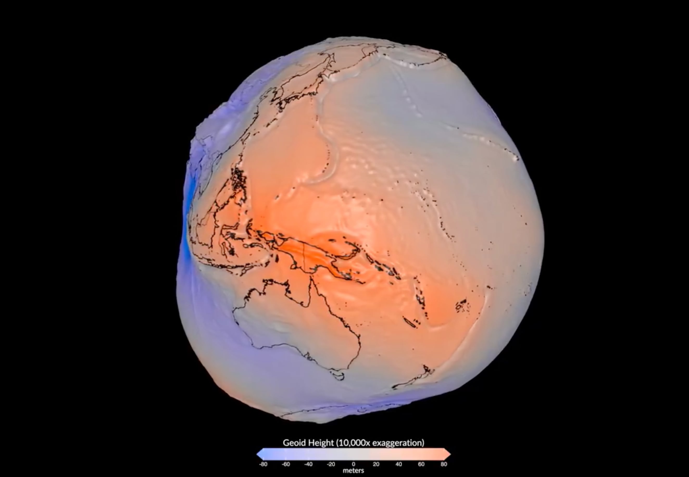
NASA has released a novel image of Earth that visually represents its geoid. The geoid is a model of global mean sea level that is used to define the "figure of the Earth." This groundbreaking visualization was created by processing over one billion observations. These observations were collected over a period of 15 years. A total of 19 satellites contributed to gathering the data necessary for this image. The geoid is crucial for understanding Earth's gravitational field and sea surface topography.
This visualization of Earth's geoid, derived from extensive satellite data, offers a unique perspective on the planet's gravitational field and mean sea level. The sheer volume of data processed—over a billion observations from 19 satellites over 15 years—highlights the significant investment in Earth observation technology. Such detailed mapping is essential for climate modeling, sea-level rise monitoring, and understanding geophysical processes. The ability to represent complex scientific concepts visually can enhance public understanding and engagement with critical environmental science, potentially influencing policy and resource allocation towards further scientific inquiry and planetary stewardship.
AI-generated to prompt reflection — not editorial opinion, not advice, not a statement of fact. How this works.