Porto Alegre streets flood as Guaíba River rises; storms loom
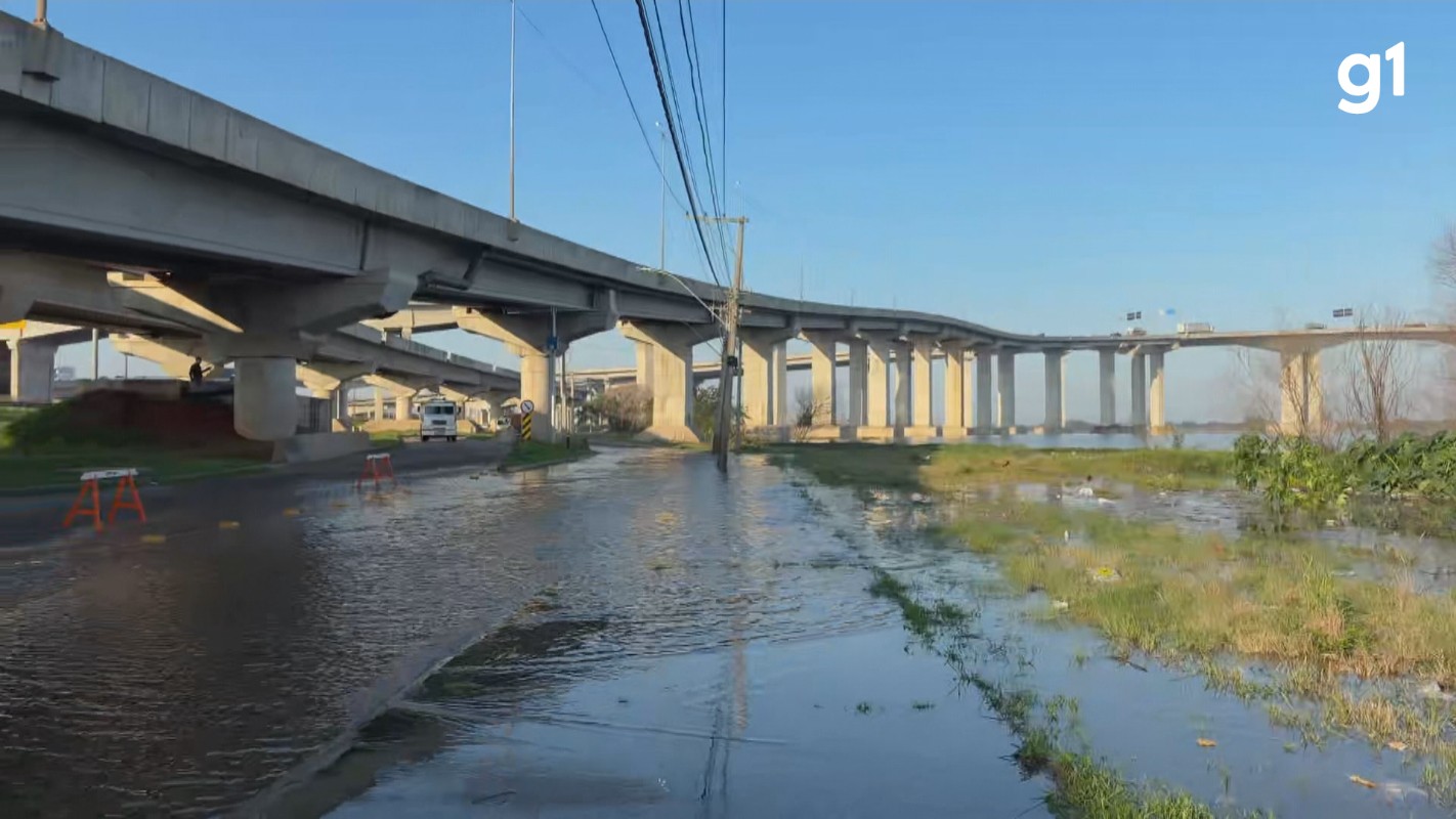
Porto Alegre is experiencing its first floods as the Guaíba and Jacuí Delta rivers continue to rise, reaching 2.52 meters at Cais Mauá by 7:15 AM on Friday, May 31st. This surge occurs amidst widespread flooding across Rio Grande do Sul's major rivers and precedes a cold front expected on Saturday, May 1st, bringing potential storms with winds up to 100 km/h. While Porto Alegre's Civil Defense considers 2.50 meters an alert level, the Brazilian Geological Service (SGB) sets it at 2.60 meters. Flooding has impacted Rua João Moreira Maciel in the North Zone, with water from the Jacuí River reaching street level and returning through storm drains, causing traffic disruptions. Civil Defense has established command posts on the Pintada, Marinheiros, and Flores islands, and in the Serraria neighborhood as a precaution. The Municipal Department of Water and Sewers (Dmae) does not anticipate closing the city's flood control gates, as current forecasts do not predict the Guaíba reaching the 3-meter inundation level in the protected area; the closure protocol is initiated at 2.84 meters. Elsewhere in Rio Grande do Sul, several rivers including the Uruguai, Jacuí, Taquari, Caí, Sinos, and Gravataí are above flood levels, with the Sinos River under a red alert for high flood risk in the Ilhas region of Porto Alegre. The weather is expected to shift from warm and clear on Friday to heavy rain and storms on Saturday, with potential for hail and strong winds.
The rising water levels in Porto Alegre highlight the ongoing challenges of urban flood management in regions susceptible to extreme weather and riverine inundation. The discrepancy in alert levels between local and national geological services underscores the complexities in defining critical thresholds and the need for unified data interpretation. As climate patterns intensify, the city's infrastructure, including its flood control systems and storm drains, will face increasing strain. This situation necessitates a forward-looking approach to urban planning that integrates climate resilience, potentially involving upgrades to drainage systems and revised land-use policies in vulnerable areas, to mitigate future risks and ensure public safety.
AI-generated to prompt reflection — not editorial opinion, not advice, not a statement of fact. How this works.