Ribeirão Preto Storm: Microburst, Not Tornado, Caused 160km/h Winds and Destruction
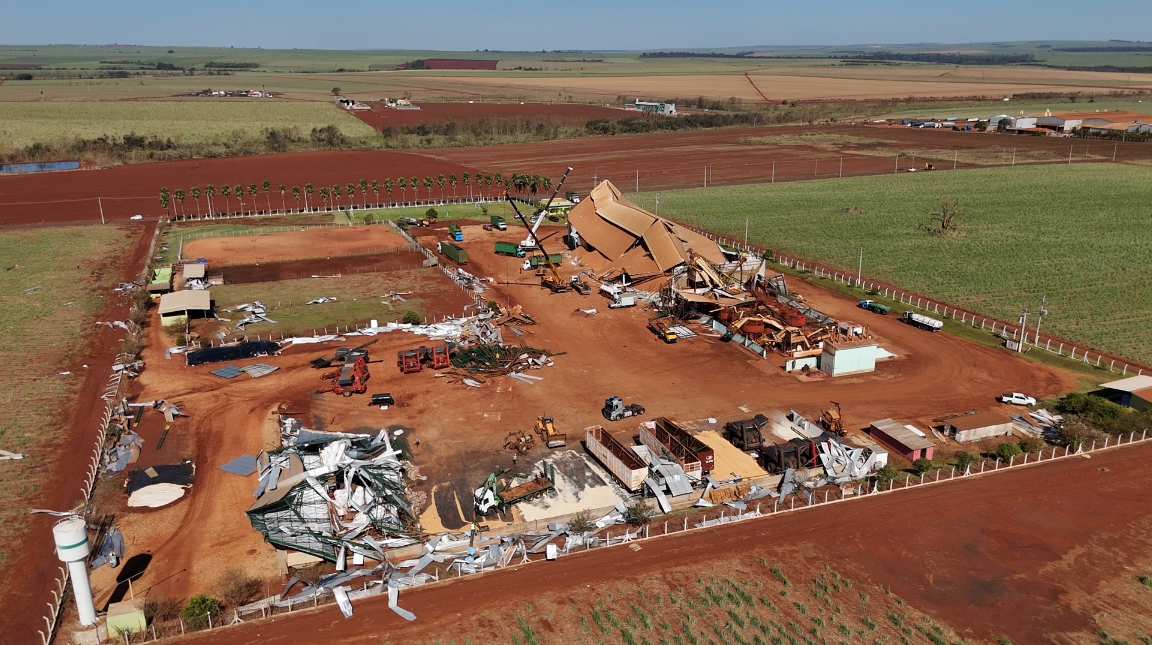
A severe storm that struck the Ribeirão Preto region in São Paulo, Brazil, on Friday, March 24th, causing one death and widespread destruction to homes and businesses, has been classified as a microburst, not a tornado, despite winds reaching 160 km/h. Meteorologist Josélia Pegorim of Climatempo explained that while a microburst can resemble a Category 1 tornado, the key difference lies in the pattern of damage. Tornadoes are characterized by intense, rotating air currents and a visible funnel cloud touching the ground. In contrast, a microburst involves a powerful downdraft of air from a cloud that spreads out radially upon hitting the ground. The storm affected several cities, including Ribeirão Preto, Guariba, Taquaritinga, Dumont, Pradópolis, and Barrinha, leaving many areas without electricity. The Governor of São Paulo, Tarcísio de Freitas, acknowledged the limitations of current meteorological models in predicting such extreme events. The affected area is estimated to be 79,000 hectares, equivalent to 110,000 football fields. The National Institute of Meteorology (Inmet) cited atmospheric conditions, including a trough in the mid-levels of the atmosphere, heat, high humidity, and an approaching cold front, as contributing factors to the development of these severe thunderstorms. Both microbursts and tornadoes are considered severe weather phenomena, originating from supercells, which are highly charged and extensive clouds. While tornadoes are generally more destructive due to potentially higher wind speeds, microbursts can cause significant damage within a concentrated area. Meteorologists note that predicting these specific phenomena with more than 24 hours' notice remains technically challenging, with forecasts typically limited to the potential formation of supercells.
The event highlights the critical challenge in accurately forecasting and communicating the nature of extreme weather phenomena, particularly those with localized, intense impacts like microbursts and tornadoes. While meteorological science has advanced, the precise prediction of where and when these events will manifest, and their specific characteristics, remains a frontier. The classification of the event as a microburst, despite its destructive power comparable to a weak tornado, underscores the importance of detailed damage assessment for scientific understanding. This incident prompts reflection on the resilience of infrastructure in regions prone to severe weather and the need for advanced warning systems that can provide actionable information to the public, even with short lead times. The difficulty in long-range prediction suggests a systemic challenge in atmospheric modeling, potentially requiring further investment in data acquisition and computational power to better anticipate and mitigate the impacts of climate-driven extreme weather events in the coming decade.
AI-generated to prompt reflection — not editorial opinion, not advice, not a statement of fact. How this works.