Rio Grande do Sul Faces Severe Storms After Tornado, Red Alerts Issued
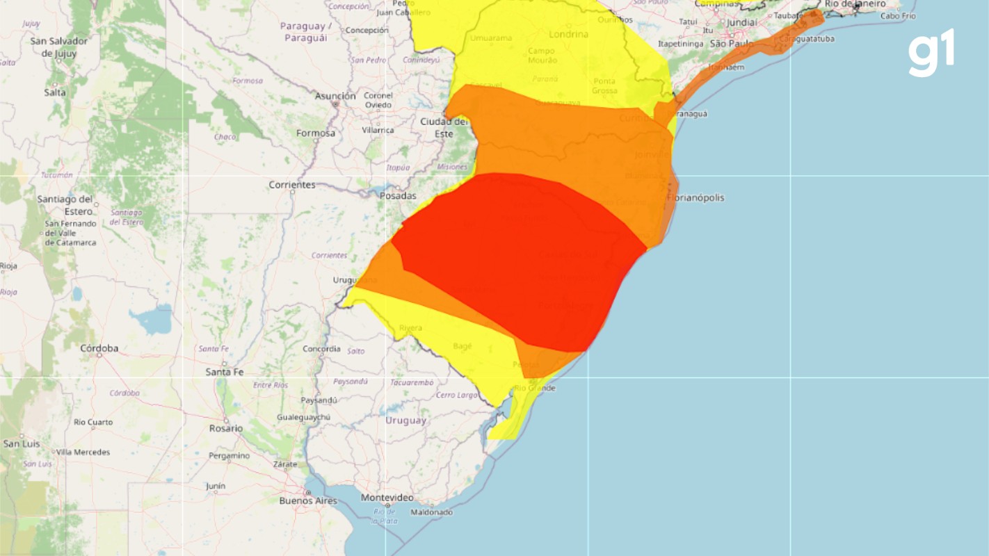
The Brazilian state of Rio Grande do Sul remains under red alerts for severe thunderstorms, heavy rain, lightning, and strong winds on Wednesday, May 29th, due to a cold front. Climatempo Meteorologia warns of dangerous conditions for multiple regions, including Porto Alegre. On Tuesday evening, May 28th, a tornado struck three municipalities in the state's Northwest: Giruá, Sete de Setembro, and Senador Salgado Filho, resulting in seven injuries. The National Institute of Meteorology (Inmet) has issued red warnings for severe storms, predicting rainfall exceeding 60 millimeters per hour, winds over 100 km/h, and hail, valid until Wednesday noon. The state's Civil Defense has also issued red alerts for flooding in the Taquari and Caí rivers, with very high risk in Bom Retiro do Sul, Caxias do Sul, and the area between São Sebastião do Caí and Montenegro. Additionally, warnings are in place for potential localized landslides, particularly in Caxias do Sul and Três Coroas, with moderate risk in several other towns. Winds are expected to range from 50-70 km/h, potentially reaching 90 km/h in isolated areas, with the highest risks concentrated in the North, Northwest, Northeast, Valleys, Metropolitan Region, North Coast, and Serra. Rain intensity is forecast to decrease by afternoon, with temperatures dropping as a cold air mass moves in. The weather is expected to stabilize on Thursday and Friday, with firm conditions and reduced rainfall, though some northern areas may see drizzle. However, a new cold front approaching from the South will bring renewed instability on Saturday, May 1st, affecting the Campanha, Western Frontier, Missões, and Central regions, with severe weather possible in cities like Uruguaiana, Alegrete, and São Borja.
The severe weather events in Rio Grande do Sul, including a tornado and subsequent red alerts for storms and floods, highlight the increasing vulnerability of regions to extreme meteorological phenomena. The issuance of multiple red alerts by national and state agencies underscores the severity of the situation and the need for robust disaster preparedness and response systems. While the immediate focus is on public safety and damage mitigation, these recurring events prompt a broader examination of climate resilience strategies. Long-term planning should consider the interplay between meteorological patterns, land use, and infrastructure development to minimize risks associated with such extreme weather in a changing climate. Effective communication and early warning systems are critical, but they must be complemented by proactive measures to build community resilience and adapt to evolving environmental conditions.
AI-generated to prompt reflection — not editorial opinion, not advice, not a statement of fact. How this works.