Santiago's Mapocho River Project Faces Flood Risk Concerns
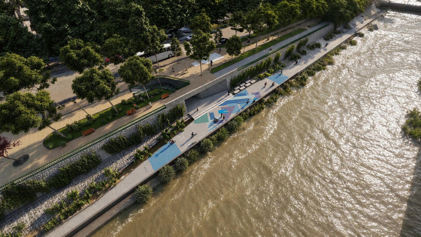
The government of Santiago has launched a bidding process for the "Paseo Fluvial río Mapocho" project, an initiative involving an investment of over 22 billion Chilean pesos. This project aims to revitalize the city's main river by constructing a 5.2 km urban promenade along the south bank of the channeled riverbed. The promenade is designed to be floodable and will connect the communes of Providencia and Santiago. However, concerns have been raised regarding the technical feasibility of an inundable urban project on the Mapocho River, which is characterized by a steep gradient and high flow velocities during floods. Recent estimations suggest that during the upcoming storm, the river could transport between 600 and 800 cubic meters per second, with speeds up to 6 meters per second, capable of causing significant destruction. The author notes that major Mapocho floods are becoming more frequent, with the current event being the second in less than five years. Therefore, it is crucial that the project adequately considers the technical viability of floodable structures or incorporates robust fluvial defenses. The author also suggests advancing the second site visit for the bidding process, originally scheduled for July 20, to July 17, believing the river's behavior during the impending storm will provide critical information for the government and potential bidders.
The proposed "Paseo Fluvial río Mapocho" project in Santiago highlights a common tension between urban development and natural environmental dynamics. While the initiative seeks to enhance public space and connect communities, its design as an "inundable" (floodable) promenade on a river known for rapid, forceful surges raises critical questions about risk management and infrastructure resilience. The increasing frequency of significant flood events, attributed to potential climate shifts or land-use changes upstream, suggests that infrastructure designed for historical hydrological patterns may be increasingly inadequate. Future urban planning must integrate advanced climate modeling and adaptive design principles to ensure that public works not only serve immediate recreational and connectivity needs but also withstand the escalating impacts of extreme weather events, thereby safeguarding public investment and safety.
AI-generated to prompt reflection — not editorial opinion, not advice, not a statement of fact. How this works.