Satellite Images Reveal Extent of Damage to Iranian Military and Nuclear Sites
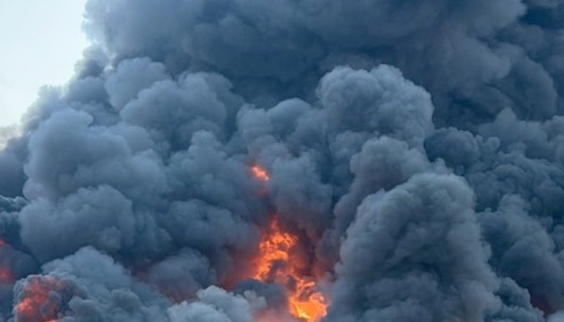
Satellite imagery has provided insights into the extent of damage sustained by several Iranian military and nuclear facilities following strikes attributed to the United States and Israel. The images offer a visual assessment of the impact on these sensitive locations. Specific details regarding the exact nature and scale of the damage to each facility have not been fully disclosed but are being analyzed. The strikes reportedly targeted sites deemed critical by the involved nations. This development follows a period of heightened tensions in the region. Further information is expected as assessments continue.
Satellite imagery provides an objective means to assess the physical impact of military actions on infrastructure. Analyzing these visuals can help de-escalate tensions by offering verifiable data, moving beyond rhetoric. Understanding the precise damage to military and nuclear facilities is crucial for international security assessments, informing future diplomatic and strategic considerations. This event underscores the evolving role of remote sensing in geopolitical monitoring and verification processes.
AI-generated to prompt reflection — not editorial opinion, not advice, not a statement of fact. How this works.