Satellite Images Reveal Extent of Damage to Iranian Nuclear and Military Facilities
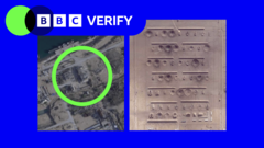
For the first time, the extent of damage to certain Iranian nuclear and military facilities has become apparent following the release of over 250,000 high-resolution satellite images. Access to these images had previously been restricted. The publication of these visuals offers a new perspective on the impact on these sensitive sites. The availability of such a large dataset of detailed imagery is unprecedented and allows for a more comprehensive assessment of the situation. This development is significant for understanding the current state of Iran's infrastructure. The release is expected to provide crucial information for international observers and analysts.
The release of previously restricted high-resolution satellite imagery provides a new, data-driven lens through which to assess the condition of Iranian military and nuclear facilities. This transparency, enabled by advanced remote sensing technology, allows for a more objective evaluation of infrastructure integrity, moving beyond speculative reporting. The availability of such extensive visual data prompts consideration of the evolving landscape of international oversight and verification mechanisms. It highlights the increasing role of civilian-accessible technology in monitoring sensitive state assets and could influence future discussions on nuclear non-proliferation and geopolitical stability.
AI-generated to prompt reflection — not editorial opinion, not advice, not a statement of fact. How this works.