Satellite Images Show Powerful Gusts Exceeding 120 km/h in Brazil's Southeast
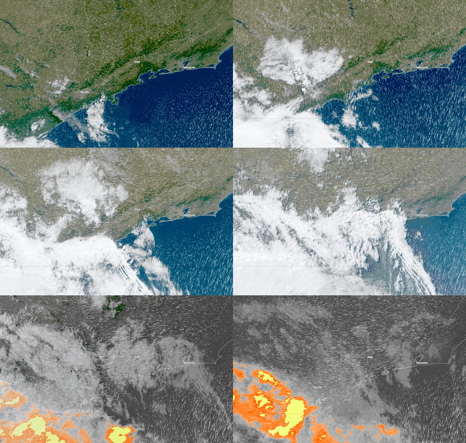
Satellite imagery captured the movement of a weather system that generated wind gusts exceeding 120 km/h across Brazil's Southeast region, specifically impacting São Paulo and Rio de Janeiro on Wednesday, November 29th. The images, provided by the National Institute for Space Research (Inpe), track cloud formations and surface-level winds from 10 AM to 7 PM Brasília time. White lines on the visualizations indicate wind direction and displacement, illustrating the system's progression over São Paulo, Rio de Janeiro, and the Atlantic Ocean. The data reveals the advance of cloudiness associated with a cold front, which, upon encountering the prevailing hot and dry air mass, formed a 'gust front.' This meteorological phenomenon, explained by meteorologist César Soares of Climatempo, occurs due to the stark contrast between significantly different air masses, leading to intense winds. The Southeast had been experiencing hot and dry conditions, while a cold front formed in Southern Brazil and moved northward. At 11 AM, clouds were concentrated over Paraná, advancing towards São Paulo and the coast. By 2 PM, this cloudiness reached the coast of São Paulo and Rio de Janeiro, and by 4:30 PM, it covered eastern São Paulo and a large part of Rio de Janeiro. Evening imagery showed continued cloud cover, with yellow and orange tones indicating cooler cloud tops over Paraná and southern São Paulo, a result of infrared data used for nighttime tracking. While satellite images track the system's evolution and area of impact, specific wind gust speeds exceeding 120 km/h were recorded by ground-based equipment. Notable gusts included 124.9 km/h in Itaí and Itaporanga, and 117 km/h in Taquarituba, primarily in the Itapetininga region and along the São Paulo coast. The passage of this gust front also caused a rapid temperature drop, with some areas in the São Paulo Metropolitan Region experiencing a decrease from around 29°C to 20-21°C within an hour, as the cold air replaced the warm surface air.
The event highlights the significant impact of atmospheric dynamics, specifically the formation of a powerful gust front resulting from a sharp contrast between air masses. This phenomenon, distinct from tornadoes, demonstrates how rapid temperature and pressure gradients can create intense, localized wind events that exceed typical forecasts. The reliance on ground-based measurements for precise wind speeds, despite advanced satellite tracking of cloud systems, underscores the ongoing need for robust on-the-ground meteorological infrastructure. Future weather modeling may benefit from enhanced integration of satellite and ground data to better predict the intensity and localized nature of such extreme weather events, particularly as climate shifts may influence the frequency and severity of such atmospheric contrasts.
AI-generated to prompt reflection — not editorial opinion, not advice, not a statement of fact. How this works.