Severe Weather Alert: Rio Grande do Sul braces for heavy rain, hail, and winds up to 90 km/h
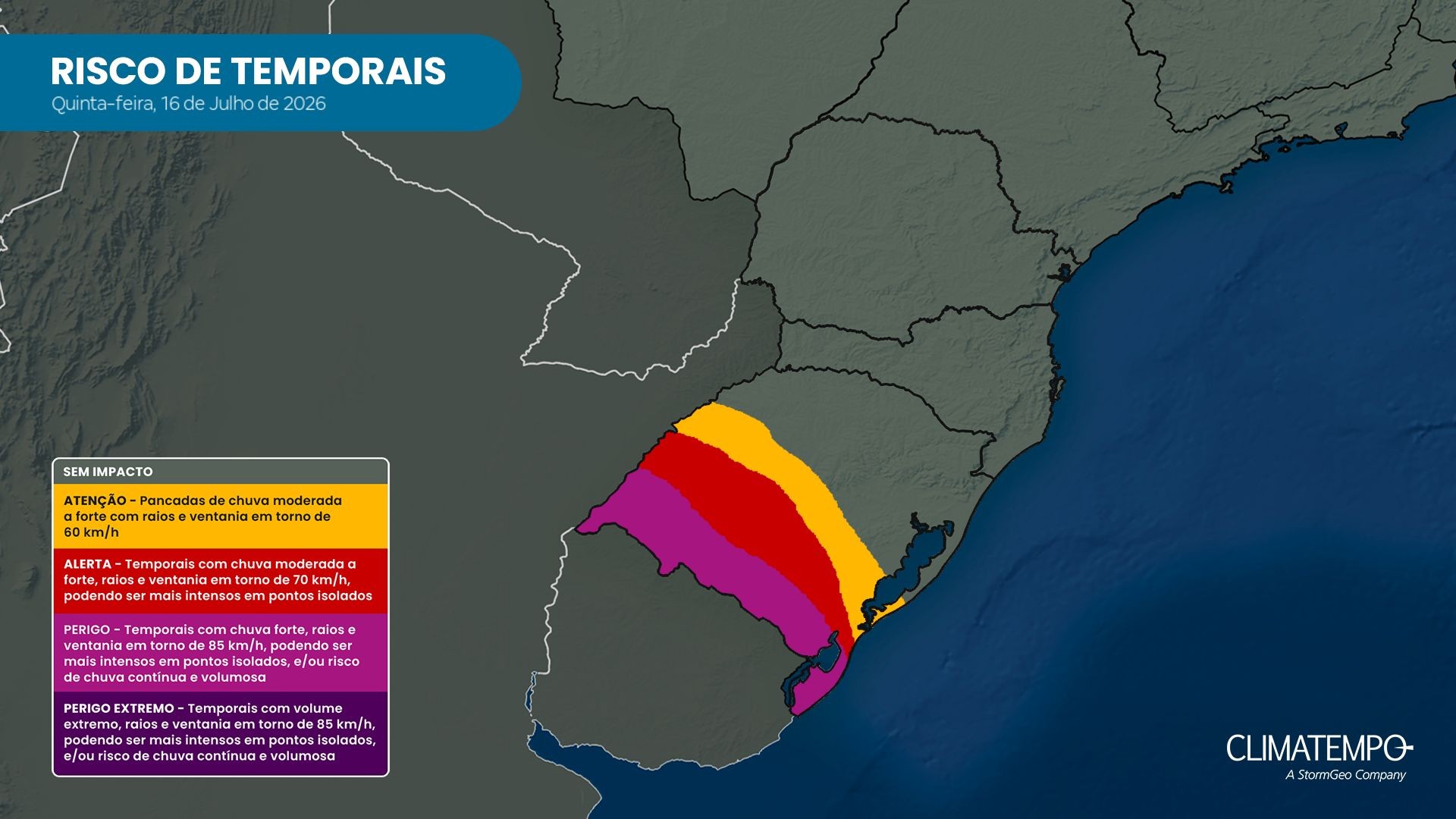
Rio Grande do Sul, Brazil, is set to experience severe weather conditions starting Thursday, November 16th, influenced by El Niño. Instabilities will begin in areas bordering Uruguay, bringing a risk of extreme phenomena such as tornadoes and microbursts. Wednesday, November 15th, will remain fair with sunshine and gradually rising temperatures. On Thursday, a cold front's advance will lead to thunderstorms developing between the afternoon and evening, particularly affecting the Western Frontier, Campanha, and Southern regions. These areas could see hail and wind gusts ranging from 70 to 90 km/h, with rainfall volumes between 10 and 50 mm, potentially reaching 70 mm in isolated spots. Climatempo Meteorologia warns of supercells capable of producing microbursts and tornadoes. The risk of storms is lower in the northern and northeastern parts of the state, while the Metropolitan Region and central areas might experience isolated late-day storms. By Friday, November 17th, instability will spread statewide, with more widespread storms and intense winds. The Campanha, Western Frontier, Central, Southern, Costa Doce, and Metropolitan regions remain at higher risk, with rainfall expected between 10 and 30 mm, possibly up to 60 mm. The weekend, starting Saturday, November 18th, will continue with frequent rain and potential disruptions. The cold front's northward movement increases risks for the Missões, Central, Planalto, Northern, and Rio Pardo and Taquari Valley regions, with possibilities of significant rainfall over short periods, leading to localized issues like flooding. The period will also be marked by atypical heat, with highs potentially reaching 27-29°C on Thursday and exceeding 30°C in some valleys on Friday, and up to 29°C on Saturday.
The predicted severe weather in Rio Grande do Sul highlights the increasing impact of climate phenomena like El Niño on regional weather patterns. The formation of supercells and potential for extreme events such as tornadoes and microbursts underscore the need for robust early warning systems and resilient infrastructure. As climate change intensifies, understanding and adapting to these more frequent and severe weather events become critical for public safety and economic stability. This situation prompts consideration of long-term land-use planning and building codes that account for heightened meteorological risks, particularly in vulnerable regions. The interplay between global climate drivers and local weather extremes serves as a reminder of the interconnectedness of environmental systems and the imperative for proactive, science-based adaptation strategies.
AI-generated to prompt reflection — not editorial opinion, not advice, not a statement of fact. How this works.