Sudeste Brazil Hit by Intense Wind Gusts Exceeding 120 km/h
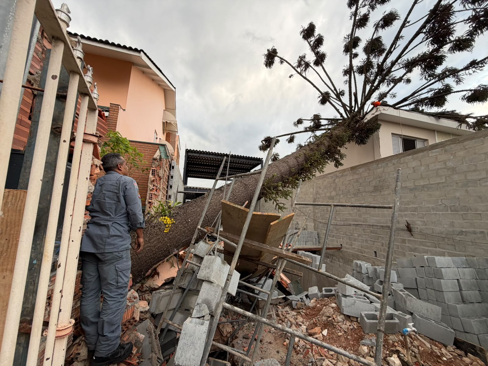
A powerful weather phenomenon, known as a "frente de rajada" (gust front), caused winds exceeding 120 km/h across Brazil's Southeast region, leading to significant damage. The intense winds, which resulted in fatalities, fallen trees, roof destructions, and power outages, were amplified by a sharp contrast between two air masses. Prior to the event, the Southeast was under a hot, dry air mass, while a cold, humid front was advancing from the South. The collision of these disparate air masses over São Paulo and Rio de Janeiro created a dramatic temperature and humidity gradient, fueling the exceptionally strong and organized winds. Meteorologist César Soares of Climatempo explained that the cold, moist air from the front met the warm, dry air prevalent in the region, leading to a rapid acceleration of wind speed at the boundary. This phenomenon is characterized by a band of strong winds that moves ahead of a cold front or storm area, pushing warmer air upwards and outwards. The gust front can manifest suddenly and affect multiple cities sequentially, even before significant rainfall arrives or in areas with little rain. Unlike a tornado, which involves rotating winds in a narrow path, a gust front spreads winds horizontally over a much wider area. The rapid progression of the cold front, moving from the South through Paraná and São Paulo to the Southeast coast in just a few hours, contributed to the wind's intensity. In some São Paulo municipalities, gusts reached up to 124.9 km/h, with significant impacts reported in the Itapetininga region and along the coast. The passage of the gust front also caused a rapid temperature drop, with some areas in the São Paulo Metropolitan Region experiencing a decrease from around 29°C to 20-21°C within an hour. The same cold front that caused the gust front in the Southeast also triggered severe storms and a tornado in Rio Grande do Sul, though the gust front and the tornado are distinct meteorological events.
The severe weather event in Brazil's Southeast highlights the critical role of atmospheric instability and the interaction of contrasting air masses in generating extreme weather. The "frente de rajada" phenomenon, while a natural process, underscores the increasing frequency and intensity of such events, potentially linked to broader climate shifts. Understanding these dynamics is crucial for urban planning and infrastructure resilience, particularly in densely populated coastal and interior regions. The rapid temperature drop and wind acceleration demonstrate the atmosphere's capacity for sudden, impactful changes. Future preparedness will require advanced meteorological forecasting and robust public warning systems to mitigate damage and ensure safety, especially as climate models suggest a continuation of such extreme weather patterns.
AI-generated to prompt reflection — not editorial opinion, not advice, not a statement of fact. How this works.