Super Typhoon Ba Vi Weakens but Still Threatens South China Sea with Strong Winds and High Waves
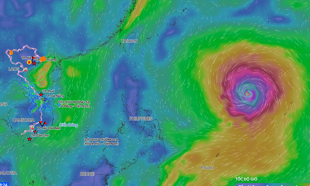
Super Typhoon Ba Vi has weakened to a Category 5-equivalent storm, with maximum sustained winds of 201 km/h. Despite the reduction in intensity, the typhoon's large circulation is expected to bring strong winds and high waves across most of the South China Sea starting this weekend. The storm's extensive reach means that maritime activities in the region will likely be significantly impacted. Coastal areas bordering the South China Sea should prepare for potentially dangerous sea conditions. Further updates on the storm's trajectory and intensity will be crucial for maritime safety and preparedness efforts. Residents in affected areas are advised to monitor official weather advisories closely.
The weakening of Super Typhoon Ba Vi from its peak intensity, while still posing a significant threat to the South China Sea, highlights the dynamic nature of weather systems and their impact on regional stability. The broad circulation of the storm indicates that even diminished typhoons can exert considerable influence over large maritime areas, affecting shipping, fishing, and coastal communities. This event underscores the ongoing need for robust early warning systems and adaptive infrastructure in regions prone to extreme weather, especially as climate patterns evolve. Preparedness strategies must account for both the peak intensity and the extended reach of such storms, emphasizing resilience in the face of predictable, yet variable, environmental challenges.
AI-generated to prompt reflection — not editorial opinion, not advice, not a statement of fact. How this works.