Tropical Depression Forms East of Philippines, Expected to Become Typhoon in South China Sea
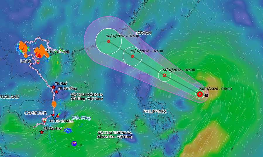
A tropical depression has formed east of the Philippines and is currently moving west-northwest. Forecasters anticipate that this system will intensify into a typhoon before it reaches the South China Sea. The storm's trajectory suggests a potential impact on the region. Further updates will be provided as the system develops and its path becomes clearer. The current position and projected path are being closely monitored by meteorological agencies. The development of this storm highlights the active weather patterns in the Western Pacific. Residents in coastal areas should stay informed about potential weather advisories.
The formation of a tropical depression east of the Philippines, with projections of strengthening into a typhoon before entering the South China Sea, represents a predictable seasonal weather event in the Western Pacific. Such systems are driven by oceanic heat and atmospheric conditions, posing recurring challenges for regional maritime safety and coastal communities. The primary focus for governance and infrastructure will be on early warning systems, effective evacuation protocols, and resilient construction standards to mitigate potential damage. Understanding the cyclical nature and drivers of these storms is crucial for long-term adaptation strategies in the face of evolving climate patterns.
AI-generated to prompt reflection — not editorial opinion, not advice, not a statement of fact. How this works.