Tropical Depression Strengthens into Typhoon Maysak
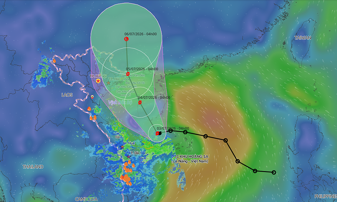
In the early morning of July 3rd, a tropical depression located in the waters northwest of the Paracel Islands intensified into the first typhoon of 2026. The storm, named Maysak, is now positioned in the western Pacific Ocean. This development marks a significant weather event early in the typhoon season. Further tracking and advisories are expected from meteorological agencies. Residents in coastal areas are advised to monitor official updates. The strengthening of this system highlights the dynamic nature of tropical weather patterns in the region. The typhoon's path and potential impact are currently being assessed.
The formation of Typhoon Maysak signifies an early and potentially potent start to the typhoon season. This event underscores the importance of robust meteorological monitoring and early warning systems for regional safety and economic stability. As climate patterns evolve, understanding the drivers behind such rapid intensification becomes crucial for predictive accuracy and preparedness. The typhoon's trajectory and strength will likely influence maritime activities and coastal communities, necessitating adaptive strategies in infrastructure and disaster response planning over the coming years.
AI-generated to prompt reflection — not editorial opinion, not advice, not a statement of fact. How this works.