US State Department Africa Map Erroneously Labeled All Countries at Global Conference
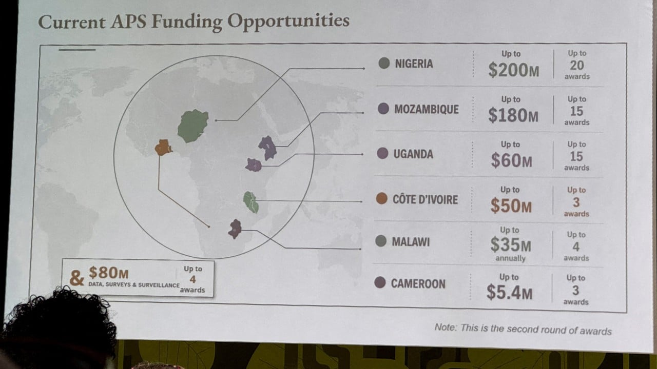
A map of Africa presented by the US State Department at a global conference in Brazil this week contained significant errors, mislabeling every country. The inaccurate map was displayed during a presentation on new health agreements at the Aids 2026 conference in Rio de Janeiro. Attendees reacted with surprise, capturing screenshots of the map and sharing them online. Reuters observed a video of the presentation which confirmed the map's presence midway through the State Department's remarks. A subsequent analysis by Reuters identified further issues with the map's depiction.
The incident highlights potential systemic issues in data visualization and verification processes within governmental bodies, particularly when engaging in international diplomacy and global health initiatives. Such errors can undermine credibility and lead to misunderstandings, irrespective of the presenter's intent. In an era where accurate data representation is crucial for informed decision-making and international cooperation, the State Department's lapse suggests a need for enhanced quality control measures. This event also underscores the importance of attendee vigilance in the digital age, where information, including errors, can be rapidly disseminated and scrutinized globally. Future diplomatic engagements may require more robust pre-presentation vetting of all visual aids to ensure accuracy and prevent unintended diplomatic friction.
AI-generated to prompt reflection — not editorial opinion, not advice, not a statement of fact. How this works.