US State Department Map of Africa Erroneously Labels All Countries
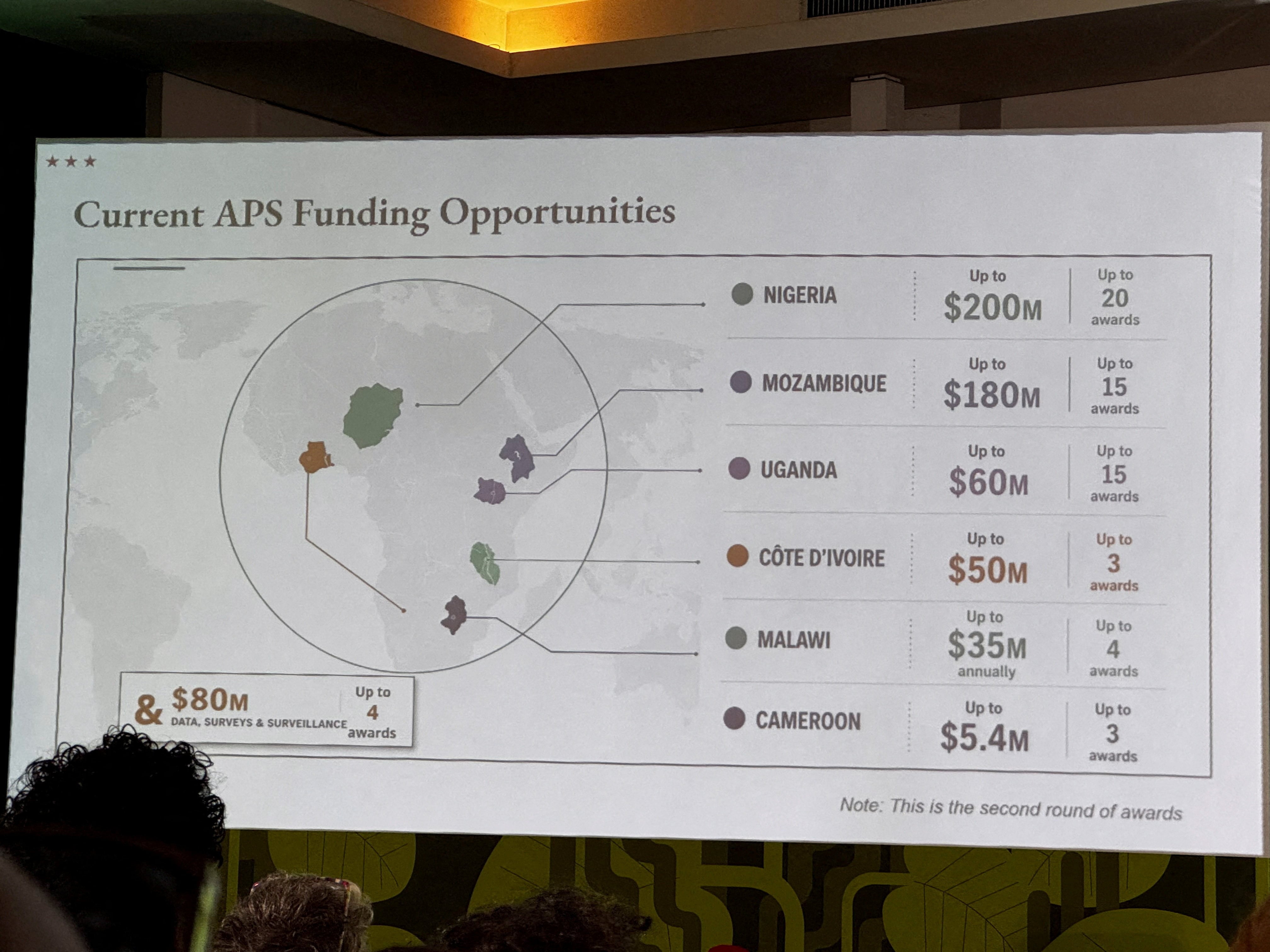
A map of Africa presented by the U.S. Department of State incorrectly identified all countries during a conference. The State Department attributed the error to a last-minute modification of the presentation. However, a Reuters investigation revealed that the image used bore a watermark from OpenAI.
This incident raises questions about the vetting process for visual aids used in official government presentations. The involvement of AI-generated imagery, particularly with potential inaccuracies, highlights the need for robust verification mechanisms before deployment. The State Department's explanation suggests a rushed process, but the discovery of the OpenAI watermark points to a deeper issue concerning the integration of AI tools into official communications and the potential for unintended consequences.
The erroneous labeling of African nations on a U.S. State Department map, attributed to a last-minute change and the presence of an OpenAI watermark, highlights critical vulnerabilities in the integration of AI-generated content into official government communications. This incident underscores the imperative for stringent verification protocols to ensure the accuracy and reliability of visual aids, especially when sourced from rapidly evolving AI technologies. The reliance on AI without adequate human oversight risks propagating misinformation and undermining diplomatic efforts. Future governmental use of AI tools will require robust governance frameworks that prioritize data integrity and accountability, balancing the efficiency gains of AI with the non-negotiable need for factual accuracy in public-facing materials.
AI-generated to prompt reflection — not editorial opinion, not advice, not a statement of fact. How this works.