US State Department's Fictional African Map Sparks Confusion
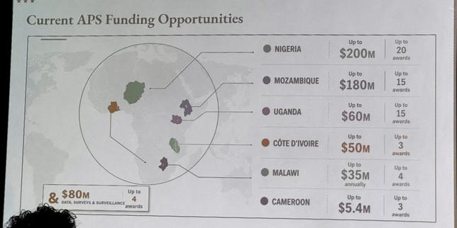
During an international AIDS conference held in Brazil in late July, the U.S. Department of State presented a map of Africa that contained significant geographical inaccuracies. The map depicted Côte d'Ivoire located in the southern part of the continent, and Nigeria was shown as landlocked within the Sahara Desert. Furthermore, Cameroon was rendered as a phantom state, implying its complete absence or misrepresentation on the map. These errors occurred during a high-profile international event, raising questions about the accuracy of materials used by the U.S. State Department in its global outreach and presentations.
The presentation of an inaccurate map by the U.S. State Department at an international conference highlights potential systemic issues in data verification and geographic information management within governmental bodies. Such errors, regardless of intent, can undermine the credibility of official communications and international cooperation efforts. In an era increasingly reliant on precise data for policy and resource allocation, particularly in critical areas like global health, the robustness of data governance frameworks becomes paramount. This incident prompts consideration of the technological and procedural safeguards necessary to ensure accuracy in all public-facing information, especially when representing diverse global regions. Ensuring the integrity of such data is crucial for fostering trust and effective collaboration on a global scale.
AI-generated to prompt reflection — not editorial opinion, not advice, not a statement of fact. How this works.