Vantor Launches 3D Satellite Mapping of Earth
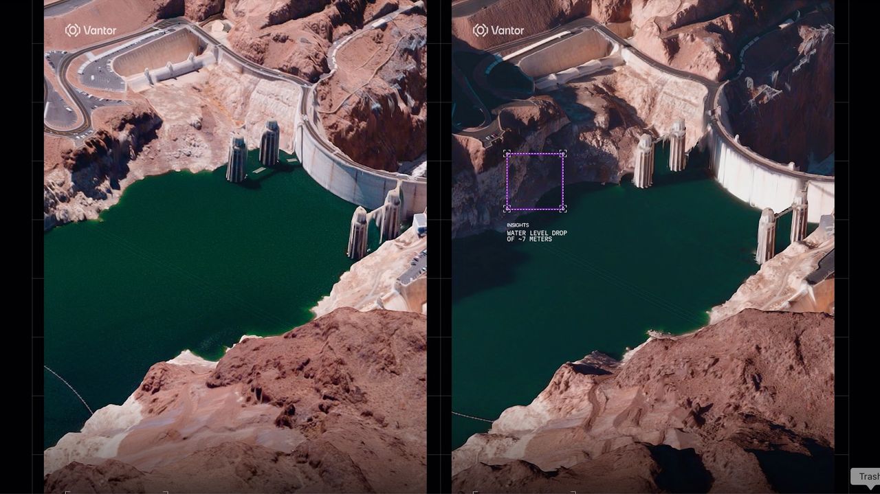
American company Vantor has introduced a new capability in Earth observation, now mapping our planet from space in three-dimensional detail. The company has unveiled stunning 3D satellite imagery, showcasing a significant advancement in how we can visualize and understand our world from orbit. This technology represents a leap forward in spatial intelligence, offering unprecedented perspectives on Earth's surface.
Vantor's innovative approach allows for a more immersive and detailed representation of geographical data. The high-resolution 3D views are expected to have broad applications across various sectors, potentially transforming fields that rely on accurate and comprehensive geospatial information. The company's development marks a pivotal moment in the evolution of satellite imaging and data analysis.
Vantor's introduction of 3D satellite mapping signifies a notable progression in geospatial data acquisition and visualization. This enhanced spatial intelligence capability could democratize sophisticated mapping tools, enabling more nuanced analysis for urban planning, environmental monitoring, and resource management. The development prompts consideration of how such detailed 3D data will be integrated into existing digital infrastructure and the potential for new applications to emerge. Furthermore, it raises questions about data accessibility, privacy implications, and the long-term economic and societal impacts of having such comprehensive planetary views readily available in the coming decade.
AI-generated to prompt reflection — not editorial opinion, not advice, not a statement of fact. How this works.