War Atlas: Interactive Map Visualizes 10,584 Wars Over 4,500 Years
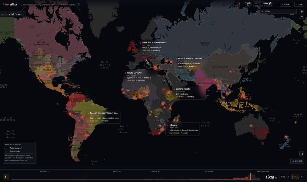
War Atlas is an interactive infographic that maps approximately 10,584 wars spanning 4,500 years of human history, from 3100 BC to the present day. The project documents the evolution of armed conflicts, showcasing weaponry from the Bronze Age to the atomic era. It details the rise and fall of 427 political entities, including empires, kingdoms, caliphates, and republics, alongside around 700 historical city names that dynamically change to reflect conquests and renaming. The map visualizes the emergence and disappearance of conflicts and shifts in political borders, drawing data primarily from Wikipedia, supplemented by specialized historical works, maps, and modern geographic data. Conceptualized by friends in 2009, its first beta version was released in May 2026. Key interactive features include a timeline from the Bronze Age to today, synchronized wars and borders reflecting imperial changes, historical city names that update with eras, and victim estimates for about 150 major conflicts where historical data varies. Users can navigate quickly through centuries or decades via keyboard shortcuts and utilize an auto-play function for historical evolution. A guided tour highlights ten historical epochs. While War Atlas is a remarkable tool, it currently has limitations, particularly for conflicts before 1500 and regions outside Europe, with some ancient borders and casualty figures for ongoing wars noted as approximate.
This interactive "War Atlas" offers a data-driven visualization of historical conflict, aiming to present a comprehensive, albeit potentially stark, view of human aggression over millennia. By aggregating data from various sources, it seeks to provide an objective historical record, allowing users to explore the dynamics of warfare and geopolitical change. The project's development over 17 years, relying on volunteer contributions and open-source data, highlights a decentralized approach to historical archiving. However, the inherent subjectivity in historical data, especially concerning casualty figures and the precise delineation of ancient borders, means the atlas represents an interpretation, not an absolute truth. Future iterations may benefit from enhanced transparency regarding data provenance and methodologies for resolving conflicting historical accounts, fostering a more nuanced understanding of conflict's complex causes and consequences beyond mere tabulation.
AI-generated to prompt reflection — not editorial opinion, not advice, not a statement of fact. How this works.